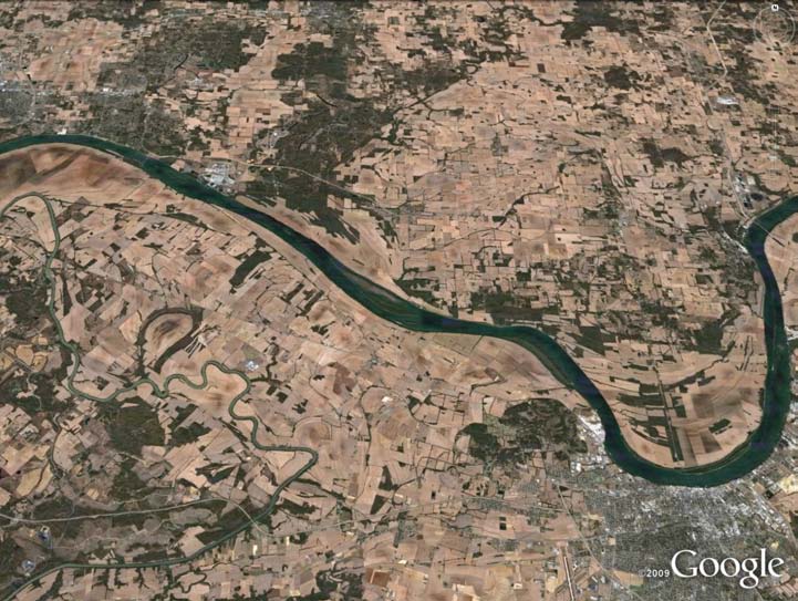
left: An aerial view of the Ohio River, near Evansville, Ind.
above: Accessing Ohio Supercomputer Center systems, Ohio State's Michael Durand obtained preliminary results for bathymetric estimates for a 100-kilometer section of the Ohio River. While the first guess does not closely match true bathymetry, accuracy increases significantly between the first and eighth cycles.
Slated for launch in 2019-20, the Surface Water and Ocean Topo-graphy (SWOT) satellite mission is a collaborative project of NASA and the French space agency, Centre National d’Etudes Spatiales. SWOT features a swath-mapping radar interferometer that will provide data on inland bodies of water, as well as mapping ocean circulation at high spatial resolution.
The mission will measure rivers, lakes, wetlands and reservoirs for water elevation and the surface area inundated by water, data from which water slope and change-over-time are derived. From these fundamental measurements, scientists can calculate surface water-storage change and estimate river discharge, two principal components of the water cycle.
“SWOT represents a fundamentally new approach to characterizing fluvial processes, especially river discharge,” said Michael Durand, Ph.D., assistant professor of earth sciences at The Ohio State University (OSU). “However, because SWOT will observe water surface elevations, but not river bathymetric elevations, the cross-sectional flow area will be observed only above the lowest observed river depth. The remaining, unknown river depth must be estimated in order to produce river discharge estimates.”
To address that issue, Durand is accessing Ohio Supercomputer Center computational resources to test strategies for estimating the unknown bathymetry of the Ohio River basin. Durand employed a numerical implementation of Saint Venant’s Equation – used to describe the response of the free water surface to variations in river flowrate and river-channel bed forms – to numerically characterize the interactions between SWOT variables. With a data assimilation approach, he will solve an inverse problem to find river baseflow depth, given the measurements of slope and width.
“The data assimilation scheme used here essentially solves the inverse problem of classic open channel hydraulics,” explained Yeosang Yoon, a doctoral student advised by Carolyn Merry, Ph.D., professor of civil and environmental engineering and geodetic sciences at OSU.
“While Saint Venant’s equation describes the response of the free water surface to changes in bathymetry elevation and width, SWOT will measure the free water surface elevation, slope and width directly. The assimilation scheme will be used to estimate baseflow depth, given SWOT measurements of the free water surface.”
For algorithm testing, a model of the Ohio River system was constructed using Corps of Engineers bathymetry data. Durand’s colleague, Doug Alsdorf, Ph.D., OSU associate professor of earth sciences, serves as U.S. hydrology lead for the SWOT mission.
--
Project lead: Michael Durand, The Ohio State University
Research title: Estimating river bathymetry using water elevation measurements
Funding source: National Aeronautics and Space Administration
Web site: www.geology.ohio-state.edu/faculty_bios.php?id=166